Visualizing the Range of Glaciers
This page served as a landing spot for sharing bits of my undergraduate environmental science honors thesis and related printmaking work. The North Cascades in Washington, the place I know as home, hold many glaciers that have complex ties to both ecological and human communities. Climate change is rewriting the state of these glaciers and the relationships that they can sustain. Although these connections are usually described by science, art is an expansive form of communicating a shifting landscape and its inhabitants. My project strove to explore a remarkable place in flux with various ways of knowing - scientific, personal, artistic, anecdotal. Enjoy these snippets, or download my entire thesis “Visualizing the Range of Glaciers: Science, Art and Narrative if you care to.
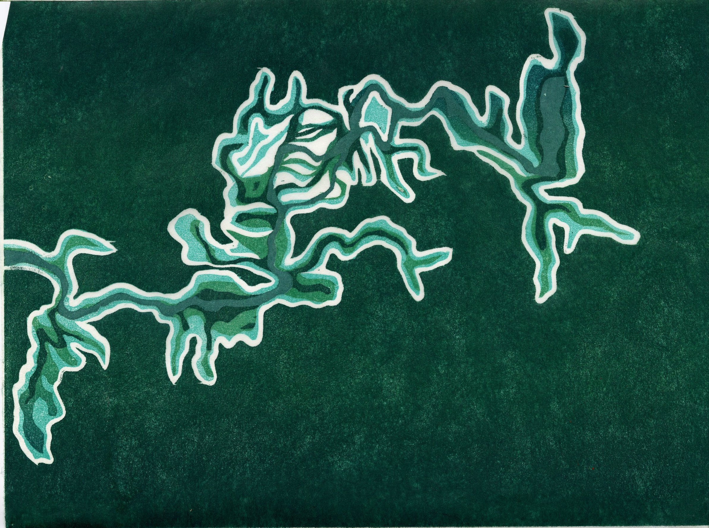
Notes from Cascade Pass

Three mountain goats amble towards the coolness of a snowfield at Cascade Pass on a warm July day.
On a recent trip to Cascade Pass and other places in the North Cascades where I had not been before, I kept a small spiral bound notebook with a black cover in my pocket at nearly all times. As ideas welled from my path, I wrote them down. I also noted sightings of species, surroundings and people. This was an unplanned practice of close observation. Writing down what jumped out at me helped me sort through what might be important, interesting or significant. In some cases, I became absorbed by minute details, like the physics of butterfly flight. In other moments, the history of the landscape took over and I jotted down the gestures of glaciation sweeping the valleys. My attention adapts to the rhythm of the land. This type of attunement is not easy for me to come by. A long span of time alone in the mountains is one place that I find it. Writing down the path of my thoughts may help preserve it.
At Cascade Pass, there was an abundance of terrain, life and visitation to take in. Writing down short notes was a way to document what was happening, a loose frame of the stories that converged at Cascade Pass that noon hour. Here, I copy my notes from an hour at Cascade Pass to share the experience of being in that new place, and to help me think about the broad and specific stories that are played out in this alpine area day after month after year. As I was taking these notes, I felt a strong sense of companionship with Terry Tempest Williams in her prairie dog days. In spring of 2004, she joined the Utah prairie dog scientist John Hoogland for fourteen days, and detailed her observations and reflections for 110 remarkable pages in the book Finding Beauty in a Broken World. I don’t think anything has taught me as much about observation in the natural world as the writings of Terry. I’ve never met her, but I could feel her presence as I took notes, being mindful of precise time and place, but also open to my own sensations and the words rising in my mind. I recognized Terry there when I was attuning myself to the character of the marmot, but cutting into my attention was the choking motor of a chainsaw doing trail work. It felt like a twin moment to one of those in Terry’s tower above the prairie dog city.
“The degree of our awareness is the degree of our aliveness.”
Terry Tempest Williams

12:10 I’m on the last couple of switchbacks rising to Cascade Pass. A set of loping tracks head straight up a snowfield. They’re about two inches wide and four inches long, with five toes and apparent claws. On one side, a line in the snow is carved by the tracks sweeping outward. Maybe the prints are too small to be a wolverine…
12:13 Sahale Arm trail is closed for trail work. A line of four people in drab national park service uniforms, bright orange helmets and large packs are walking towards a switchback on the closed trail.
12:15 I arrive at the saddle and settle into a nook in the talus. To my north is Sahale mountain. To the south is an impressive chain of peaks: Johannesburg Mountain, Cascade Peak, the Triplets, Mix-up Peak… and they continue.
12:17 Notice snow sliding down the cracked snow patch below Johannesburg mountain col: henceforth known as J col G, Johannesburg Col Glacier, although it is probably just a snowfield and not permanent ice.
12:30 Group of three mountain goats walk up the west side of the pass. They march up a user trail to a patch of snow already scattered with hoof and boot prints. Mom beds first, then the baby. The subadult wanders a little further to the shadow of a tree upon the snow. They get up and move again after 2 minutes of rest.
12:32 J col G cracks and rumbles. The body splits off 2 big snowballs. They roll down a steep slope of snow and break apart in midair, over the waterfalls.
12:35 J col G rumbles again. I wish I had binoculars. There is a heap of bluish crumble below the steep north face of Johannesburg mountain.
12:36 Goats rebed, on a southern aspect of the snowfield. It’s a warm, dry day. To the West are a few clouds. Their shade is welcome.
I notice that below Cascade Peak and the Triplets is a snowfield with a bergschrund and cracks. There is not ice visible. The snowfield is shaped like a ghost with long arms and pieces of its belly missing.
12:40 A rumbling rockslide on west side of Mix-up peak. Triggered by waterfall? Spray and stone fall off the cliff. All of these peaks are hewn from forbidding dark stone, broken only by snow ribbons clinging to the gullies.
Notice a cornice on the east rib of Triplets
N snowfield of Mix up peak has a little schrund
12:43 Man approaches resting goats. They run off. Man shuffles after them.
Noticing all of the vegetation around me: thick pink heather, hundreds of young spruce trees wafting in the breeze. Rodents shriek.
12:47 Distinct call of pika
12:50 Intricate meadowlark-like bird song on west side of pass
12:53 Hiking couple confirms J col G has been crackling for the last half hour. More chunks break off. The waterfall appears to burst for a moment. J col G looks like it could slide off the slope at the slightest echo of its own fracturing.
Looking north west, the base of a broad snowy peak is visible. The top is clouded.
To the south east, a line below the peaks appears. It heads below Mix-up peak, towards what my map says is Cache Col. Looks like footwork. Could it be the Ptarmigan traverse?
12:58 3 day-hiker kids and parents walk down the trail. They reach a bend in the trail and point down to something. I hear water flowing beneath the snowfield I sit near.
13:00 I walk down the trail to where the kids were pointing. I see a parking lot. Dozen cars.
13:05 Three older men pass by, on their way back to the parking lot. They hike in the Cascades a lot. I ask what changes they’ve seen. They haven’t seen any significant changes here but they exclaim at the glacial change they’ve witnessed on Mt. Baker.
13:06 Cross back over the official top of the pass. Unexpectedly, there is a full semicircle of boulders and flagstone paving create a very structured resting place there. A couple sits on the rocks. “Wow, a fully furnished lookout” I say in passing. They nod and laugh and look east.
13:09 Walking south on a user trail to the start of the Ptarmigan traverse. Goat fur adorns the limbs of spruces like wisps of a colder season. I notice that the alpine huckleberry plants don’t have berries yet, but squishy pink bells midway between fruit and flower. Sense of profound peace in the sun and breeze. Look East to McGregor – it has hardly any snow. Librarians Ridge is bare and tan. From here I can only see a few swoops of white on the northwest ridge. There has been a lot of change within the past month. New plants unfurl where days ago there was snow. I find a perch. The range of observation topics is remarkably wide.
13:14 Grouse woofs in the spruce. Goat scat fills the ditch of the climbers trail.
13:17 A motor roars across the cirque. The National Park Service crew working on Sahale Arm trail has power tools and hammers.
13:22 A large, lone hoary marmot lounges on a boulder in the midst of the climbers trail. The sun is hot. I crouch beneath a sapling before I reach the marmot, hoping to give both him and I some peace. He notes my awkward rustling and cheeps at me. From the shade beneath the spruce tree I can see Sahale Peak, a snowy pyramid. On the other side is Sahale Glacier, I saw it when I hiked past Horshoe Basin. Another impressive something peeks beyond the arm of Sahale mountain… Buckner Mountain? I feel hungry again.
13:27 Marmot tires of my watchful eye, sneezes, and enters a cave in the talus.
More chainsaw.
Pelton Basin below me is tranquil, half snowed and half soggy meadow. I have a strong urge to go swimming. Since the trail to Doubtful Lake is closed I will have to wait until I go down from the pass. I have already moved 11 miles today, and there are 11 miles back to my camp. I feel gratitude for having the ability to travel quickly, and see much. I think about adventure scientists, people who can utilize unique skillsets to take data in remote places.
13:31 Birdsong throws me out of my quiet thoughts. Is it time to get down?
13:36 A bald eagle floats over the pass. Soft song of wind in the spruces is torn by the chainsaw, again.
13:46 I leave the pass.
“We have forgotten the virtue of sitting, watching, observing. Nothing much happens. This is the way of nature. We breathe together. Simply this. For long periods of time, the meadow is still. We watch. We wait. We wonder. Our eyes find a resting place. And then, the slightest of breezes moves the grass. It can be heard as a whispered prayer.”
Terry Tempest Williams.

Hoary marmot loafs on a warm rock
4: Andeorama

Andeorama: My finished scanned drawing, unlabeled and uncolored.
Andeorama
(made-up noun)
shorthand for “Andes Panorama,” an unbroken depiction of the Andes mountain range and a window into the question: What effect are melting glaciers having in South America?
This is a project I have been working on for the past couple of months. It has taken a lot of deliberation and exactitude to stay true to the data that inspired the visual. At the same time, I have let myself loose with certain lines of personal experience. I don’t know if this illustration can accurately be called art, or science. This process has made me think more deeply about if it is possible for work to fall into both camps.
The data:
Last year, Two Decades of Glacier Loss along the Andes, a study led by Inés Dussaillant, was published in Nature Geoscience. This research investigates the glacier mass changes in the Andes during the period 2000-2018. Later I will go into more detail depicting the regional changes, the sub periods of the study, and the downstream impacts of the glacier mass changes.
The idea:
After reading the Dussaillant paper, I thought one way to represent the extent and variety of effects that climate change has upon glacial systems in the Andes would be a lengthy illustration of the Cordillera, in the style of Alexander von Humboldt's 1807 illustration of Chimborazo and Cotopaxi. On one end would be the profile of Chimborazo, then the ridgeline would take on the shape of the Dry Andes and then the Patagonian Andes. Under this ridgeline, little titles and illustrations would depict the regional changes that Dussaillant et al identify. This illustration would combine an ode to the scientist/humanist Humboldt, who believed in the integration of art and science, with the scope of the change happening in the Andes under modern climate change.

Humboldt’s Tableau Physique (1807), a painting that captures the expansive and groundbreaking manner in which Humboldt approached studying the volcanoes of Ecuador.
In 1802, Alexander von Humboldt made the trek to Chimborazo with the help of indigenous Ecuadorian guides. Chimborazo was then believed to be the world’s tallest peak. Although a deep chasm did not allow the group to reach the summit, this expedition is notable for several reasons: it was the highest human climb in recorded history for 30 years, it depended on collaboration with the local indigenous people, it informed thinking about climate zones, and it resulted in a remarkable output of art-fused science that engaged the public. Humboldt’s Essay on The Geography of Plants includes the illustration Tableau Physique. A dramatic painting of Chimborazo and Cotopaxi is framed by detailed text. The columns contain the expeditions scientific observations of everything from barometric pressure to the presence of howler monkeys. To me, this variety of measurements is stunning in how it incorporates the full spectrum of the sciences.
Numerous drafts of Andeorama are in the works. I will create various versions in English and Spanish that highlight glacier characteristics, and the regional changes. I’ll also explain how I chose to depict some of the ecological and social impacts. Here is a sample:

Further Reading and Resources:
Fundación Glaciares Chilenos: A Chilean organization promoting the education and protection of glaciers in Chile, with some great online resources.
YaleEnvironment360 reports on: Andes Meltdown: New Insights Into Rapidly Retreating Glaciers
Glaciares de los Andes Centrales registran dramático retroceso durante la última década y perderán su capacidad de abastecer los ríos from País Circular. This article breaks down the implications in the Central Andes from the Dussaillant paper in common language (if you read Spanish!)
A striking and emotional telling of this story is told in Glacier Shallap – Or the Sad Tale of a Dying Glacier from Trans.MISSION and Erika Stockholm
2.2: Company Creek
Following Bob up Company Creek to the powerhouse intake
The Power House
Every morning, Bob Nielsen pedals up to the Stehekin Powerhouse, part of the Chelan County Public Utility District. The Powerhouse sits beside Company Creek, a few miles up the Stehekin River valley from Lake Chelan. Around the PUD complex lie trucks, cones, rain gauges, transformers and power poles. A stout second building houses more supplies. Webs of utility poles are strung overhead. Obviously, this is the nexus of Stehekin’s power supply. A two-foot diameter pipe emerging from the woods hints at the source. The pipe ducks underground into the Powerhouse, which is whirring though thick cement block walls. A gushing and frigid torrent emerges from the downstream wall of the powerhouse. Right beside the loud outflow, an ouzel (American dipper) family keeps their nest year after year. Bob suspects they have long term hearing loss.
Inside the powerhouse, a large pale green form in the middle of the room emits a great deal of noise. It’s a Pelton wheel turbine. A single jet of high pressure creekwater from the penstock shoots horizontally into cups placed along the wheel, turning the turbine.
In the control room, the walls are padded with wavy gray foam. Forest light beams into the small room through a half-open window. You can see the lower segments of the penstock outside. A monitor shows the cubic feet per second running through the pipe- 17.66 cfs. In the winter, it could be lower, around 10 cfs.
A photograph of the shrinking S-glacier over Trapper Lake hangs squarely on the wall. Bob, a who is perennial source of excellent mountaineering tales, tells me he first hiked into this area in 1981, and they had a bit of an epic because they took a route mainly over rock, not the glacier. The next time Bob passed by Trapper Lake the glacier was noticeably smaller than in 1981. Now that glacier is gone. That route once taken would be different and probably tricker now. The rocky cathedral walls above Trapper lake are barren, steep and slick. The old photograph is a haunting reminder that glaciers can become ghosts— a possibility literally casting a dimmer future for this community.
Living in a small town, Bob manages for efficiency. He strives to create reliable energy from renewable sources, minimizing the use of the backup diesel generators. He also is charged with solving power outages and keeping the power lines clear of limbs and leaves. Bob’s mission at the Powerhouse is to keep a steady amount of water running from the intake to the turbines. There are different tasks every day- in the summer there are trees and rocks to move from the streambed, in the fall there are leaves to clear from the intake grate and in the winter there are snowdrifts to shovel. The operation is running smoothly on this June morning. Water is simply obeying gravity, creek to pipe to creek, with the added benefit of passing through the Powerhouse and turning a turbine.
Bob moves actively around the Powerhouse, glancing over dials and gauges, ensuring that the electricity supply is aligned with the demand in town. About half of the power is consumed by the National Park Service. The rest goes towards powering the homes and businesses of Stehekin’s ~60 year round residents, ~200 summer residents and services for waves of summer tourists. When the hydroelectric cannot keep up with demand, a 75kw induction generator automatically starts up. This relies on a little bit of diesel to keep things running. When the flow is shut off or blocked, one of the twin 300kw backup diesel generators has to be fired up. Diesel smoke wafts through the small valley for an hour or two, and the lights stay on. A cleaner solution – a shipping container sized battery – is coming, but for now, the diesel generators serve as the backup electrical source for Stehekin. Elements of this hydroelectric system has been used sturdily since 1964, but the efficiency of the project really depends who is managing it. If Bob were less keen on advancing the sustainability and self-sufficiency of the Stehekin community, or less eager to clear leaves from the intake four times a day in the fall, a lot more diesel would be used.

The Intake
We walk alongside the penstock pipe up to the intake. Because the water for the powerhouse is drawn from within the rocky walls of a canyon, accessible only by path, everything up here is hand operated. Bob has traversed this path thousands of times, in all seasons, so he has dozens of stories to fill the ½ mile walk. We stroll beneath an underhanging mossy cliff face, across a sturdy bridge and up to the grated channel of the intake. In the channel box, some of the icy water drops down to enter the pipe. To keep enough water flowing in and around the intake area, rocks in the channel sometimes have to be broken apart and moved, particularly after large floods rearrange the channel.
In June, this creek is strong with icy blue water. Streambottom rocks are masked by the roiling current. It is loud. The torrent is amplified between canyon walls. Talking is reserved for other spaces- this is one of the creek’s place to be heard. It is also lush. Salmonberry and alder with their roots in the canyon bottom strive for light, shooting broad leaves over the water surface. The lushness of the intake is a gateway to the upstream world: where water moves wild and uncharted on its path from ice to river.
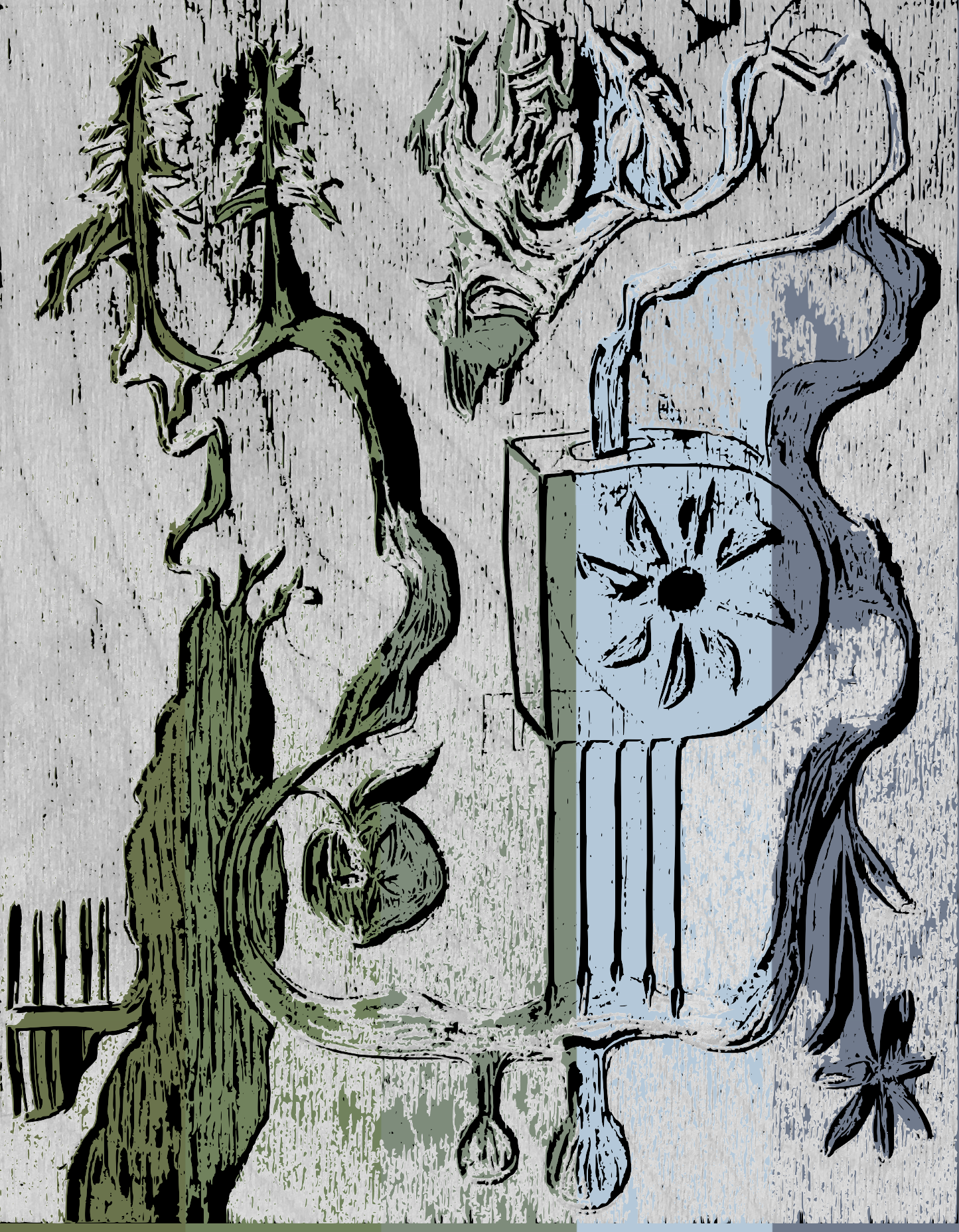
Stehekin water and power: a work in progress. This rendition is based on a carved piece of plywood (which will eventually be a woodcut print), and the colors of Lake Chelan. The carving shows the many shapes and bodies that Company Glacier water assumes on its path to the lake: river, plants, power, agriculture and cedar trees are just a few of the participants.
Towards a Glacier: Inhabitants
Reaching a glacier is a humbling act. Ice builds on high, cold terrain. Accessing the toe of a glacier, or even finding a good view of the ice, is often a multi-day ordeal. If you ever arrive, the ice has probably been reconfigured from the solid blob shown on your map to a fragmented or shrunken holdout of ice. Few people have reason to seek glaciers out. Runoff just happens, right? Can we even witness melting? I think that our understanding of our communities and ecosystems— and how they are affected by climate change— is hindered by this unfamiliarity with ice.
The Company Glacier sprawls across the north face of Bonanza peak, which at 9,347 feet is the tallest non-volcanic summit in the Cascade Range. As the crow flies, the glacier lies 10 miles away from where Company Creek enters the Stehekin river. Since there are only 5 miles of trail in the direction of the glacier, I know there’s no chance that I’ll reach the ice in a day. According to Bob, bushwhacking up the creek is not an efficient strategy. However, with the hours between powerhouse tour and dinnertime, I seek to encounter some of the inhabitants of the drainage and find a point where I can observe the glacier.
A birds eye view from near the summit of Bonanza Peak: The valley in the left half of the photo contains Company Creek. The glacier is unseen below and off to the left. Photo and trip report by Eric Hoffman found here.
I set out briskly uphill, but quickly I am bogged down by noting the presence of all the other beings of the Big Watershed. Bear grass washes over the thin path. A robin eggshell teeters in the duff. Rufous-colored sparrows hop between lichen covered branches. Fallen trees, even a deposit of snow from an avalanche cover the trail. While we were walking below, Bob filled the drainage with stories—of scared dogs, feline prints in snow, cougar looming over the creek. Now I’m ascending the ridge, seeing the biodiversity fan out from under me. Each step is alive with the possibility of seeing a new species combined with the risk of crushing an insect or an eggshell, and being stung by wild nettles.


In The Etiquette of Freedom, Gary Snyder says we ought to “take ourselves as no more and no less than another being in the Big Watershed”
A handmade sign hangs from the arms of a tree. Cedar Cathedral Camp. I walk down the path, and a few feet away from the gurgling Company creek, the dusky trunks of six great western red cedars rise straight up. The sky is dimmed by the spread of large, old limbs. The cedars trap cool, calming air beneath their canopy. Few plants grow in the shade apart from the calypso orchids (Calypso bulbosa) blooming in the moist and decaying soil.

“You want to be quiet in instinctive deference to the cathedral hush and because nothing you could possibly say would add a thing.” Robin Wall Kimmerer

These trees must be very old. I measure them with my wingspan – 2, 3 ¼ , 4, 4 ½, 4 ¾ arm lengths around. They range from a diameter of 4 to 8 feet at my height. Some have sweeping buttresses at the ground. The network of strong interlocking roots below this grove must be incredible. These cedars have been lapping from the Company Creek for hundreds of years. Their existence in this watershed suggests a history of reliable, favorable cedar growing climate. By the steady flow of glacier-fed Company Creek, they have outcompeted fast growing species and raised this cathedral.
“Given all cedar’s traits – slow growth, poor competitive ability, susceptibility to browsing, wildly improbably seedling establishment—one would expect it to be a rare species. But it’s not. One explanation is that while cedars can’t compete well on uplands, they thrive with wet feet in alluvial soils, swamps, and water edges that other species can’t stand. Their favorite habitat provides them with a refuge from competition” Robin Wall Kimmerer
The Watershed View
Five miles up the Company Creek trail, the stream is frothing through the bedrock in whites, grays and greens. I take photos of the water, curious if these colors are different than a creek with no glacier source. Across the bank, a winter wren bobs its sharp tail. Like the American dipper at the powerhouse, I wonder if this bird retains its hearing in the midst of glacial runoff’s roar, or if all the birds of this watershed are deaf.
I scramble 800 vertical ft up the western side of the drainage, ascending through a new mosaic of species. Seepages are crammed with pearly succulents, Columbia lewisia, Indian paintbrush and geraniums. Atop rocky outcrops, small kinnikinnick shrubs and penstemon hug the ground. I climbed up here hoping for a view of the Company Glacier, but it remains just out of view from the first bluff I reach. I scamper across a waterfall and up some very steep slopes to a second outcrop. From there, the mountain hugging-clouds part just enough to reveal the ramparts of Bonanza Peak, and amidst them, the peripheral pieces of Company Glacier. Most of the glacier is still snow covered.

The sighting comes rather anticlimactically. This is what I have been seeking for hours of moving- a blurry photo of the edge of a glacier that is still miles away- but this day has not been lost. The real magic along Company Creek – the stories filling the geographic expanse between ice and powerhouse—is dwelling in the plants and animals that you must either crane your neck upward or crouch down into the duff to observe.
Taking careful note of the watershed inhabitants has me wondering - how many of these species rely on the cold, consistent flows provided by the Company Glacier? Will they remain here in 10, 20 or 100 years, when the glacier has melted, and the north face of Bonanza peak is just a staggering wall of rock? Surely human people are not the only ones who will miss the presence of ice. Will the six cedar trees go thirsty, fall and rot away? Or will winter snowfall on the high slopes of Bonanza Peak keep enough late summer flow after the glacier has been lost? I imagine conducting a watershed census, asking each inhabitant how it will respond to future climate. That can’t happen for various reasons (how would I verify the signatures of lupine or hemlock or chipmunk #244?), but I cannot stop wondering about the differences in biodiversity between glaciated and non-glaciated creeks (spatially or temporally) in the North Cascades.
Glacier, creek, cedar, powerhouse, ouzel, river. I just spent a day following water, documenting its many forms. There is no simple explanation for where this water goes. I have just stepped through an inhabited drainage, and I know this creek is the edge of a complex and recurring pattern: in between mountaintop ice and the hydropower station along the river, the Columbia River watershed is coming alive in thousands of ways. I began my day thinking about the utility of water, from a human perspective. Now I am considering the many little spores, glands and stems that utilize water as well.
One watershed, changing with the climate. Thousands of stories both rooted and washed away.